
You can find on this page the map of Madrid metro. Madrid metro, subway, tube or underground is a transit system serving the city of Madrid (Spain) with the urban, suburban & commuter train, the tram or the bus. The metro network has 13 lines and 318 stations forming a rail network of 182.1 miles (293 km).
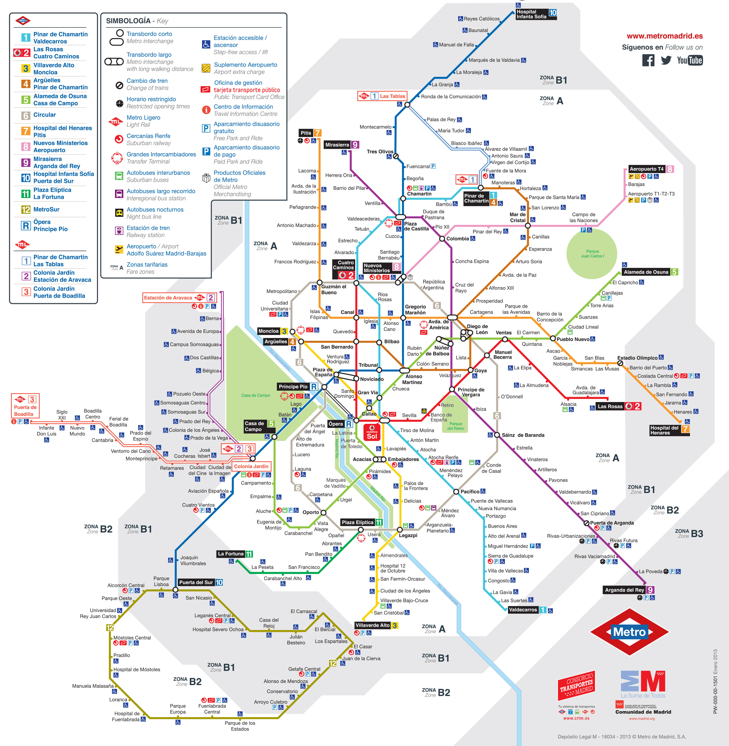
Madrid subways which transport 560.9 mllion passengers per year, exist since 1919 and are operated by Metro de Madrid.
Its network includes the following 13 lines:
• Line 1 : Pinar de Chamartín ↔ Valdecarros
• Line 2 : Las Rosas ↔ Cuatro Caminos
• Line 3 : Villaverde Alto ↔ Moncloa
• Line 4 : Argüelles ↔ Pinar de Chamartín
• Line 5 : Alameda de Osuna ↔ Casa de Campo
• Line 6 : Circular
• Line 7 : Hospital del Henares ↔ Pitis
• Line 8 : Nuevos Ministerios ↔ Aeropuerto T4
• Line 9 : Mirasierra ↔ Arganda del Rey
• Line 10 : Hospital Infanta Sofía ↔ Puerta del Sur
• Line 11 : Plaza Elíptica ↔ La Fortuna
• Line 12 : Metrosur
• Line R : Ópera ↔ Príncipe Pío


