
You can find on this page the map of Madrid suburban train. The Madrid cercanías, urban, suburban & communter train is a transit system serving the city of Madrid (Spain) with the subway, the tram and the bus. The commuter train network has 9 lines and 89 stations forming a rail network of 230 miles (370 km).
Madrid trains which transport 880 000 passengers per day, exist since 1990 and are operated by the RENFE (Red nacional de los ferrocarriles españoles).
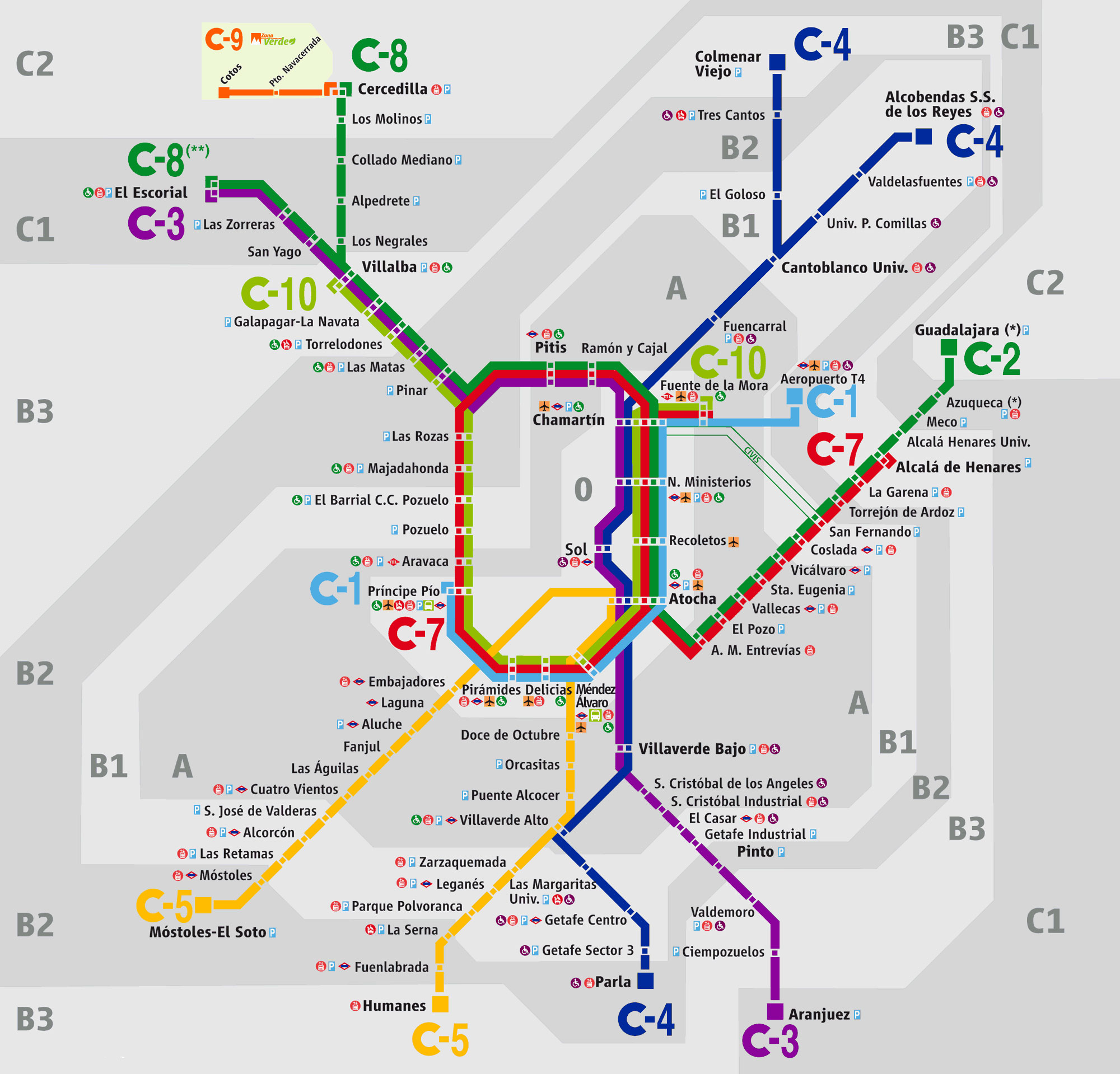
Its network includes the following 9 lines:
• Line C-1 : Príncipe Pío ↔ Aeropuerto T4
• Line C-2 : Guadalajara ↔ Chamartín
• Line C-3 : El Escorial ↔ Aranjuez
• Line C-4 : Alcobendas-San Sebastián de los Reyes / Colmenar Viejo ↔ Parla
• Line C-5 : Móstoles–El Soto ↔ Humanes
• Line C-7 : Alcalá de Henares ↔ Chamartín
• Line C-8 : El Escorial / Cercedilla ↔ Atocha
• Line C-9 : Cercedilla ↔ Cotos
• Line C-10 : Villalba ↔ Fuente de la Mora


